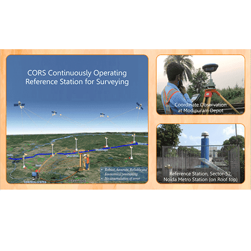
Continuously Operating Reference Station
NCRTC is using Continuously Operating Reference Station (CORS) network with multiple Global Navigation Satellite System (GNSS) base stations which are located at stable locations. These stations operate 24 X 7 at a distance of 5 to 10 km along the corridor, which eliminates dependence on distance, ionospheric & manual errors in survey. Using the rovers within the CORS Net, surveyors can provide accurate (x, y) coordinates on ground (within 10 – 12 mm accuracy of location) and eliminate the existing process of everyday orientation of Total Station. This saves time without the fear of manual errors. CORS technology provides real time precise coordinates for the measured locations and is capable of ensuring 5-10 mm accuracy in location points for accurate civil structure alignment.


